Mount Tammany
| Overall | ★★★☆☆ |
| Difficulty | ★★★☆☆ |
| Kid friendly | ★★★☆☆ |
| Parking | ☆☆☆☆☆ |
| A variety of hiking trails | ★☆☆☆☆ |
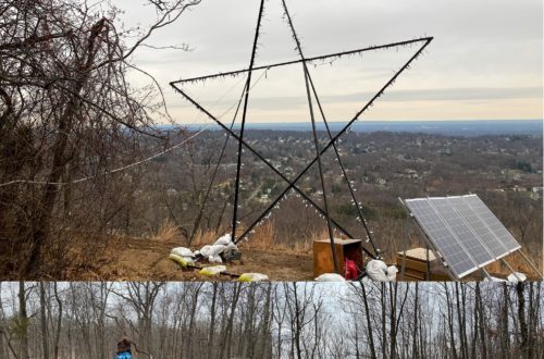
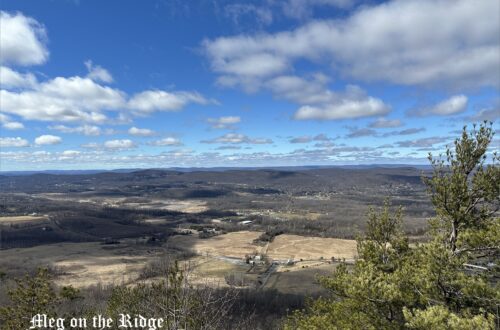
Mount Tammany is a relatively simple hiking course that gives you a sweeping view of the Delaware Water Gap, which makes this popular spot a hiking trail I recommend. On a weekend with good weather, the trail can be packed with people. There is a large and free-of-charge parking lot right along Rt. 80, near the last exit in NJ. There are some simple facilities there, but it might be good to stop off in the little shopping area before arriving at the parking lot beforehand (if you are coming from NJ). We stopped at the Travel Center in Columbia (2 Simpson Rd, Columbia, NJ 07832).
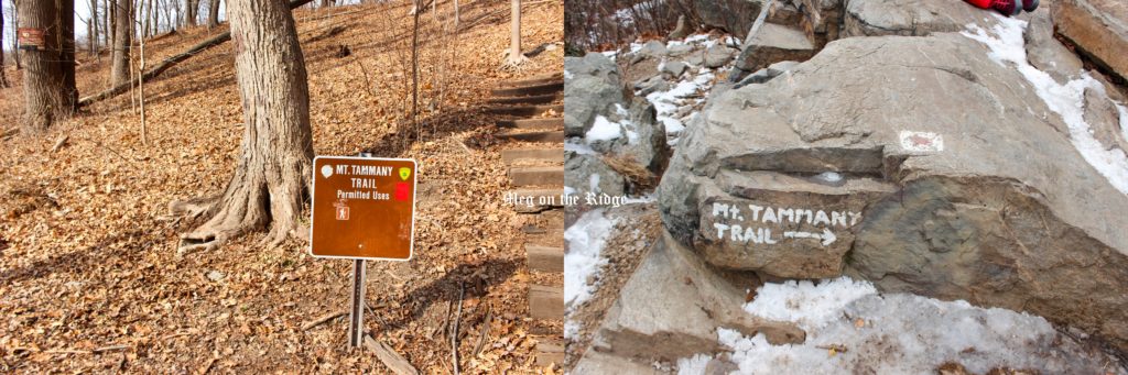
The mountain has two trails, a red and a blue, that together form a loop. The red loop is 1.2 miles, and the blue is 2.4 miles. I recommend taking the red trail up and the blue trail down. Going up the red trail, there are a lot of rocks and cliffs underfoot, so I highly recommend hiking boots. The ascent is not so steep, so it is not that hard of a climb. There are two spots on the red trail where you can get a great panoramic view of the Delaware Water Gap. At the summit, there are rock surfaces that you can sit on and look down at Rt. 80. Since we went up in the winter, we were treated to the sight of a frozen Delaware River.
Then, we took the blue trail down. The blue trail was an even more shallow descent than the red trail was going up. In the winter the trail is often frozen over with ice, and since there are no large rocks, there is nothing to stop you if you slip. It is good to wear microspikes in winter so that you can enjoy your hike safely. Along the way you will also be able to see Dunnfield Creek and the Appalachian Trail. Dunnfield Creek does not feature a waterfall, but you can still enjoy its rushing currents.
Give this a try if you are looking for an easy day-hike with a good view of the Delaware Water Gap.
Address: Kittatinnies Region, Hardwick Township, NJ 07825
Park Trail Map – Printable
Free parking
Elevation: 1,243feet
Length : 3.6 miles heavily trafficked loop trail
タマニー山は、デラウエア・ウォーター・ギャップ を一望できるハイキングコースの中で比較的簡単なので、人気スポットのハイキングコースでおすすめです。気候がいい日の週末は、多くの人でにぎわいます。大きめの駐車場は、80号沿い、NJ最後の出口直近にあり、無料です。トイレは簡易のものが一つありますが、事前に近くの街ですませておくことをお勧めします。我が家はコロンビアのTA Travel Center(2 Simpson Rd, Columbia, NJ 07832)ですませました。赤と青の二つのコースのループトレイルになります。赤は1.2マイル、青は2.4マイルです。赤が上り、青は下りといった感じなので、どちらのコースも試したいひとは、赤のコースから山頂を目指して、帰りは青のコースをおすすめします。
上りの赤のコースは、たくさんの石や岩が足元にあるので、ハイキングシューズを履いていくことをおすすめします。 上り 坂では緩やかなので、登りやすいと思います。赤コースでは2カ所、デラウエア・ウォーター・ギャップ を一望できるポイントがあります。山頂では岩肌に座って、80号を見下ろすことができるのも面白いです。我が家は冬にのぼったので、デラウェア川が凍っているのを見ることができました。
帰りは、青のコースです。下り坂が続くので、冬場の場合はスパイクを装着していくと、より安全にハイキングを楽しむことができます。途中、Dunnfield Creek(ダンフィールド・クリーク)やアパラチアントレイルを見ることができます。 ダンフィールド川は滝ではありませんが、勢いがあるので楽しめると思います。
気軽にデラウエア・ウォーター・ギャップを一望したいハイキングに出かけたい人は、一度訪れてみてください。
気に入ったら、クリックをお願いします。
If you like this article, please click here! Thank you for your support.